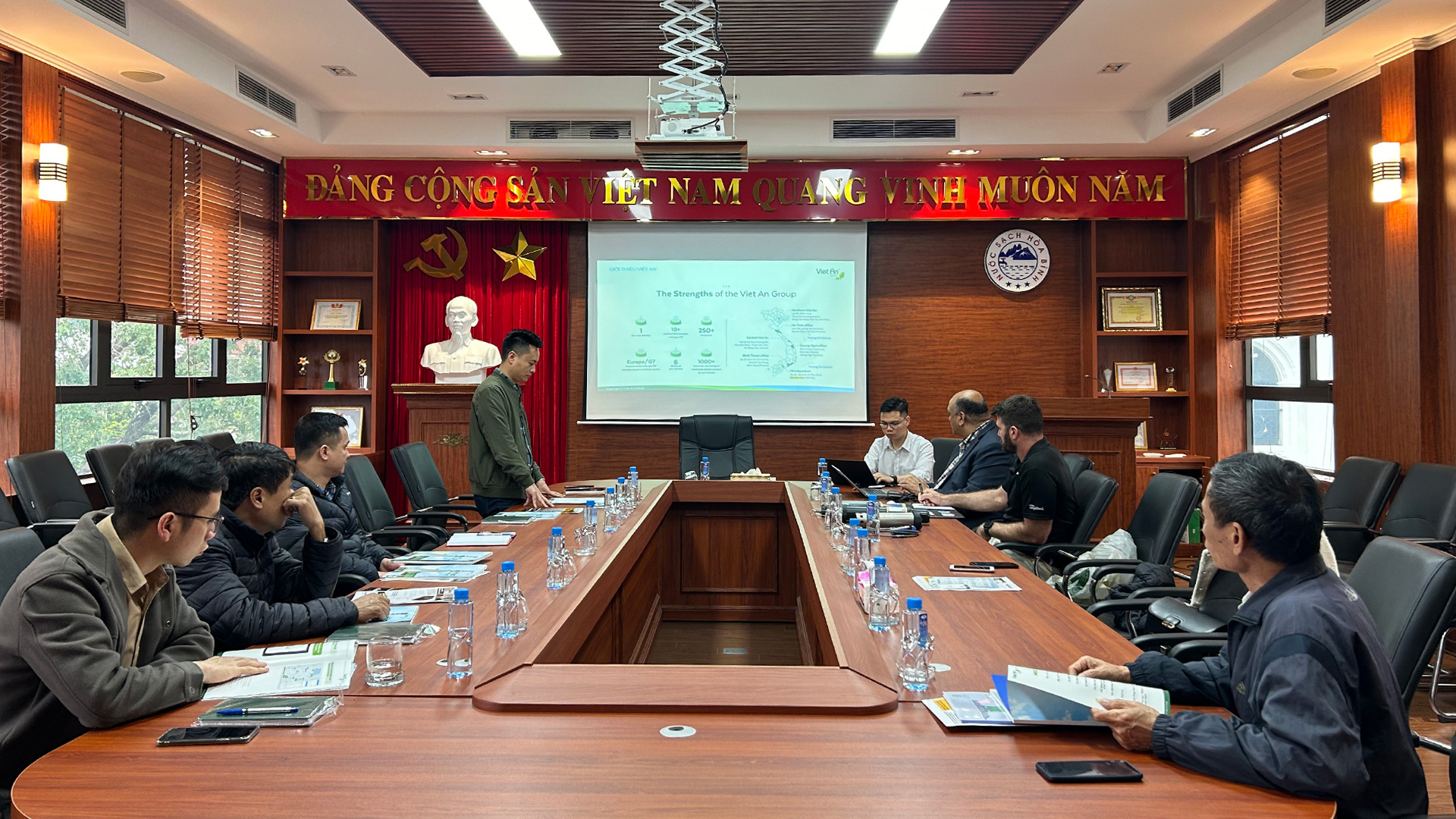
Viet An Environmental Engineering Joint Stock Company (Viet An Enviro) is proud to be an authorized agent of Esri Vietnam. We specialize in providing License Download of ArcGIS software for desktops, servers, mobile devices and developer tools, in addition to ArcGIS Online, Esri CityEngine, Esri Production Mapping.
1. ArcGis cho máy bàn (ArcGIS for Desktop)
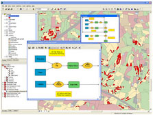
Desktop GIS is a platform for building, editing and analyzing geographic knowledge and improving your decision making. ArcGIS for Desktop software includes ready-to-use tools and data for building process models, code, and workflows to help you get better answers and predictions. and examine relationships in your data.
2. ArcGIS for Server (ArcGIS for Server)
ArcGIS for Server allows you to create, manage, and deliver Web-based GIS services to support desktop, mobile, and Web mapping applications.
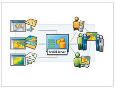
To create GIS services, you use ArcGIS for Desktop to create geographic content, such as maps and GIS tools, and then publish that content using ArcGIS for Server software. . So that geographic content can be used anywhere in your organization and on the Web.
ArcGIS for Server simplifies access to GIS services for GIS professionals, mobile workers, as well as knowledge workers without any experience in the field. GIS field. With ArcGIS for Server, you can centrally manage your spatial data assets – including your imagery data.
In addition, ArcGIS for Server gives you a scalable GIS server platform, so it can be deployed on a single machine to support many small workgroups, or it can be distributed across multiple server to support applications of a large organization. You can also deploy ArcGIS for Server on a Cloud computing platform.
3. ArcGIS for mobile devices (ArcGIS for Mobile)
ArcGIS Mobile helps organizations deliver GIS features and data from central servers to mobile devices. You can use ArcGIS Mobile software to deploy intuitive and effective mobile geographic information applications that improve the accuracy and availability of GIS data across your organization.
ArcGIS Mobile's easy-to-use applications enable even field workers without extensive geographic information experience to:
- Create a mapSSpatial query
- Spatial query
- Draw nomarly
- Integration with Global Positioning System “GPS”
- Editing GIS data
4. ArcGIS for Developers
Esri provides tools, components, and software to help you: Build and deploy cross-platform GIS applications, Publish and consume REST or SOAP GIS web services, Create maps simply from the data inherent in your organization.
+ Developer Network: The Esri Developer Network (EDN) is an annual subscription that provides an efficient way to subscribe to Esri ArcGIS products and tools. Whether you are a network, desktop, mobile, or server developer, EDN has the resources you need to build GIS software applications and solutions.
5. ArcGIS Online
ArcGIS Online creates interactive maps and apps and shares them with everyone quickly and easily, without having to install or set up anything.
Sign up now for a trial version of ArcGIS Online software and experience how easily your agency will access information, create and share maps and applications.
6. Esri CityEngine
Enri CityEngine is a tool used to convert geographic map data from 2D to 3D, and upload it directly to the website platform, especially being able to edit and analyze the results achieved, and fully integrate functions. Functionality with ArcGIS software, can export several corresponding geographic vector formats.
7. Esri Production Mapping
Esri creates and produces “Esri Production Mapping” (formerly PLTS for Arcgis-Foundation*) that helps geospatial production organizations with jurisdictions gain significant business benefits by managing and publish highly accurate data and mapping products from limited resources. It provides a widespread and shared working environment for teams of various sizes to enhance the quality and value of geospatial data and mapping products through standardization. , repeatable processes, and configure your entire production process.
With Esri Production Mapping you can:
+ Manage and build a smart central geographic information system process to ensure consistency across all your operations.
+ Improve user productivity by standardizing data collection and validation for mapping, workflow development, and data management.
+ Streamline database development through complementary design patterns, building tools, and instant object property validation.
+ Implement an efficient and streamlined database backtesting process by building automated tasks to check and control spatial data.
+ Standardize and produce detailed maps based on tools for creating and maintaining original data, setting symbol sets, page elements, and map types.
+ Access new tools, documentation, and predefined assemblies through the ArcGIS Resource Center website.